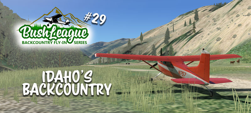
Spring is starting to spring, so it’s a great time to return to the Frank Church – River of No Return Wilderness Area in Idaho. Make sure you have your ELT ready to go as we’ll visit some a few more difficult airstrips in this area. A very special thanks to Milosanx for creating/sharing one of the sceneries this month!
Bring a big engine(s) and leave your GPS behind, grab your sectional and your favorite low and slow bush plane… and let’s get going! Wear your life jacket. 🙂
Bush League Basics:
- Everyone is welcomed! Whether you’re an expert or beginner with flight simulators, radio communications, or navigation, etc., you’re invited! We’re a friendly bunch and enjoy learning from each other.
- The best aircraft for these events are those that can handle short, narrow airstrips. STOL mods are not mandatory, but helpful. Fat tires help make the bouncy strips that much more enjoyable. Several CSL files are available to correctly render other aircraft.
- We encourage you to join the VATSIM network and use the CTAF frequency of 122.8 to announce positions. We will not be in communication with ATC unless you plan to extend your flight into a controlled airspace.
- We’ll also use the Downwindsim Discord voice channel during the flight for non-ATC related chit-chat.
- As always, the main goal of these flights is to have fun and practice good airmanship. The event is intended to be VFR, so you are free to configure your weather and time of day as you see fit.
Flight Information:
The event takes place on Monday, March 7th. Let’s plan to meet at Johnson Creek (3U2) for a quick flight briefing at 8:00pm EST (0100z) with departures immediately after. The idea is to get your sectional out and explore/find a few additional airstrips located in area. We’ll depart Johnson Creek, head to Indian Creek, Thomas Creek (Easter egg… some of you might know about this one), Marble Creek, Mahoney Creek, Cougar Ranch and then Lower Loon Creek. (Sounds like we might be up a creek.) There’s no time limit or itinerary, so stay as long as you’d like and explore.
X-Plane Scenery Installation Instructions:
First of all, this month’s fly-in begins in areas that we’ve been to in BL #17, so, visit that page and download/install that scenery and ortho. Next, we’ll be visiting a few airstrips in the next tile to the east.. +44-115. All the airstrips are developed, tested and designed to work with Ortho4XP scenery tiles. At a minimum, you’ll need to cook at least two tiles… +44-115 and +44-116. These are the settings I used to cook my development tile… I’d recommend the same! Also, I used “Arc” for the imagery source as this provided a bit more consistency throughout the tile. Again, I’d recommend the same. I’ve also provided this link to modified OSM data files for the +44-115 tile. These help shape the terrain immediately around airstrips and also add A LOT of missing water features. If you’re not sure how to use the modified OSM data, here’s a short video. While you’re at it, you might want to cook some of the surrounding tiles too.
A word about forests and trees… there are several addons providing updated forest coverage data for X-Plane, some free, some payware. I’ve used (for various reasons) “antwob’s” free U.S. Forests addon which uses the default tree texture set, but more accurate location data than the default x-plane data. I’ve also modified the tree forest type for this tile in Idaho. That modified forest overlay file is linked here. This file should go in your X-Plane/Custom Scenery/us-forests/Earth nav data/+40-120 folder. The us-forests scenery folder (SCENERY_PACK Custom Scenery/us-forests/) should be just above your “SCENERY_PACK Custom Scenery/Global Airports/” line in your scenery_packs.ini file. What’s Idaho without lots of coniferous trees? Right???
You’ll also need to download these three airstrips from me (DWS) and ID67 Lower Loon Creek from our friend Milosanx. Download the .zip files and extract the folders to your X-Plane/Custom Scenery folder. Note: If you’ve been collecting Idaho airstrips for a while (as I have), do some housekeeping as there’s been several versions of some of these airstrips out for a while. My design approach on these airstrips is to keep them as realistic as possible, without causing slowdowns on sim performance due to too many objects or vegetation.
Scenery Library Requirements: OpenSceneryX, CDB-Library, The Handy Objects Library… plus whatever Milosanx needs for his version of Lower Loon.
*** X-Plane Scenery UPDATE ***
Melvin Leroy helped me identify two potential problems.
#1) I forgot to include a patch file for D47 Cougar Ranch. Please download this small .zip file and extract the contents to your Ortho4XP/Patches/+40-120/+44-115 folder. If the folder doesn’t exist, create it! Then recook +44-115. This will help flatten the runway a bit at Cougar Ranch.
#2) Make sure D47 Cougar Ranch IS ABOVE 0U3 Mahoney Creek in your scenery_packs.ini file. Otherwise, the scenery at Cougar Ranch doesn’t show up.
If you get stuck or have a question, drop a message on the DownwindSim Discord bush-flying text channel. There’s a bunch of friendly folks that’d be happy to help. I look forward to have you tag along on the Bush League Backcountry Fly-In Series! -DWS
