With a new plane (SoulMade Simulations DHC-2 Beaver) and a quest for the unknown, I set out the other day to do some exploring.
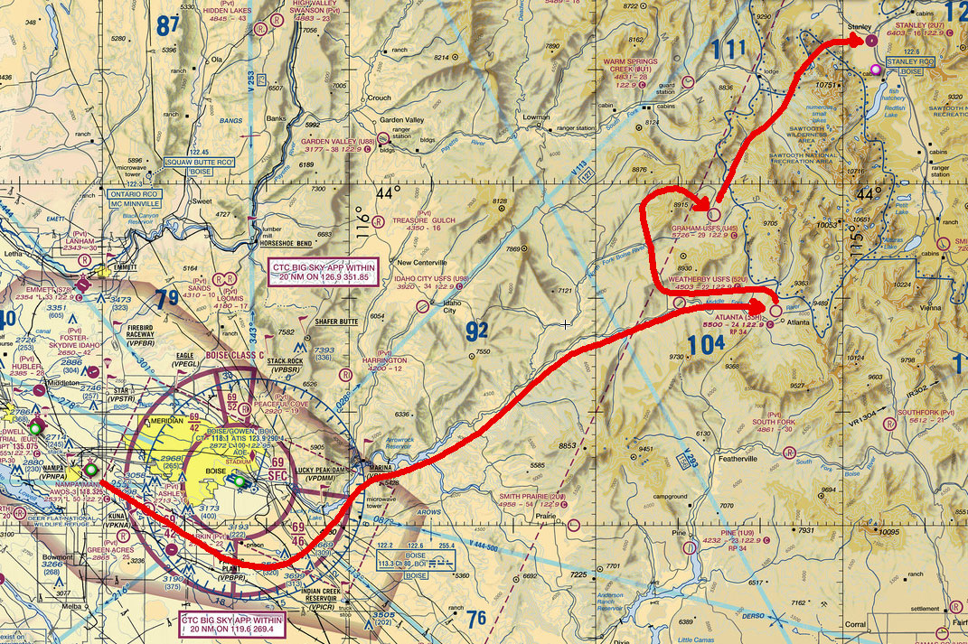
The flight began just outside of Boise, ID at a small airfield called Nampa Municipal Airport (KMAN). I got the finicky Beaver started and warmed up, and took off toward the southeast, low enough to stay out of the Boise class B airspace. The plan was to see if I could find my way around some of the back country with just a map and looking out the window. After passing by the class B airspace, I headed north up towards Lucky Peak Dam, and then followed the valley northeast looking to find some small airfields scattered throughout the Idaho hills.
I won’t give you the play-by-play here in this post, (I made it to Weatherby USFS (52U), Atlanta (55H), Graham (U45), and finally over the Sawtooth mountains to Stanley (2U7) but if you’re interested in all the gory details, check out the video of the virtual flight. I had so much fun, I’m working on modifying some of the scenery to add signs at the airfields to confirm where I’ve landed. As I mentioned in my previous post… it’s easier than you think to get lost up there! And don’t run out of fuel!
Here’s a map of my first flight in the area. It’s going to take some time to learn my way around those parts, and of course, feel free to join me in the Idaho Back Country!
You’ve got a fever, and the only cure is more back country flying!
I’m blaming the whole thing on you! 🙂 It is tons of fun… thanks for sharing the idea, it’s a whole new area of flight simulation to learn about and explore.