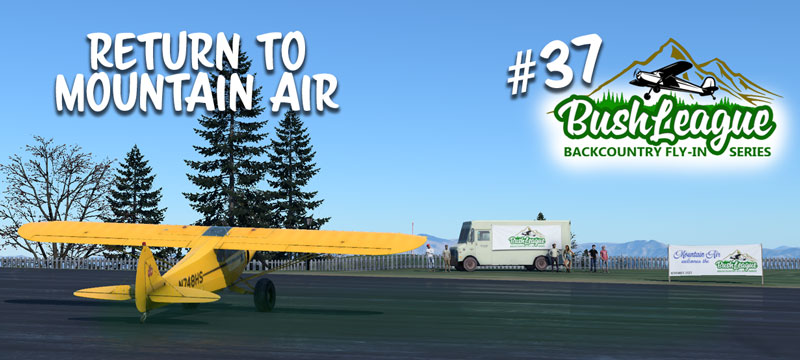
Happy Anniversary and welcome back to the mountains of North Carolina. It was November when the original Bush Hooligans hatched up the crazy idea of a monthly event. Little did we know, three years later we would still be going strong. It is wonderful to be back to enjoy another Bush League adventure with friends old and new.
For this Fly-In, DownwindSim has created a few new airstrips… a modified 2NC0 Mountain Air, TN54 Mountain View, TN11 Mountain Outlaw, and KI35 Harlan located to the northwest of Mountain Air. These airports are postage stamps camouflaged among the area farms and fields, creating a challenge to even the most experienced back country pilot.
This month’s fly-in will be structured as a round trip. Meet at 2NC0 Mountain Air on Monday, November 7 at 8:00pm EST (01:00z, Nov. 8) for a quick briefing, then depart to visit our new spots. The order is up to you as long as you plan a return to Mountain Air as the final stop.
Bush League Basics:
- Everyone is welcomed! Whether you’re an expert or beginner with flight simulators, radio communications, or navigation, etc., you’re invited! We’re a friendly bunch and enjoy learning from each other.
- You’re welcome to fly airplanes and/or helicopters. The combination of elevation and runway length favor higher performance aircraft.
- We encourage you to join the VATSIM network and use the CTAF frequency of 122.8 to announce positions. We will not be in communication with ATC unless you plan to extend your flight into a controlled airspace.
- We’ll use the Downwindsim Discord voice channel for a quick pre-flight briefing around 8pm EDT, and also during the flight for non-ATC related chit-chat.
- The main goal of these flights is to have fun and practice your navigation and airmanship skills. The weather this time of year can be limiting… adjust as you feel necessary.
Ortho4XP Requirements:
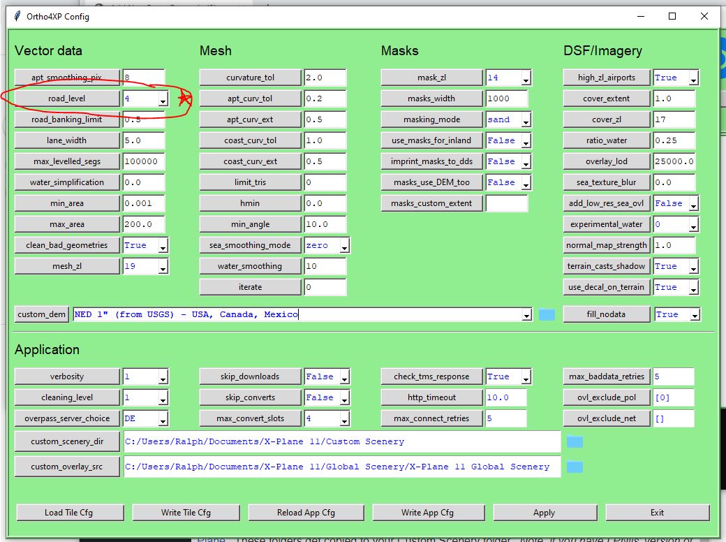
This scenery package and adventure is designed to be used with Ortho4XP scenery tiles. Your mileage may vary if you don’t have this part. Here’s my settings for Orthox4XP. ARC Imagery and NED 1″ DEM was used during development.
Here’s the link to the completed tile +35-083. This file contains a high-res version mesh of the Mountain Air Airport area. zOrtho4XP_+35-083.7z You might have this already if you flew last year, Nov. 2021.
You’ll also need to cook Ortho tiles +36-083 and +36-084.
First, the patch files… these flatten and shape the terrain on the airports. These files need to be downloaded and placed in your Ortho4XP/Patches folder and then cook or recook the tiles. (The file path should look something like mydrive:/Ortho4XP/Patches/+30-090/+36-083/TN54.patch.osm, etc.)
There are UPDATED OSM data files you need to copy to your Ortho4XP/OSM_data/+30-090/+36-083 and +36-084 folders. If you already have these tiles made, remember to recook your tiles (+36-083 and +36-084) after copying these files into the appropriate folders. If you don’t know what to do with these files, this tutorial might help. If you still get stuck, ask in the DWS discord channel.
Scenery Information:
And finally, here’s the scenery files…
Mountain Air v3 (if you have other versions of Mountain Air, delete them and keep this one)
TN11 Mountain Outlaw
TN54 Mountain View
I35 Tucker-Guthrie Memorial (Harland, KY – You’ll Never Leave Harlan Alive)
I am trying to set up the scenery tiles for different bush league flights. I unfortunately I do not seem to have a lot of success. I tried to cook several tiles (+39-079 and +38-079) in the Appalachian mountain. I found in particular that the mountains look rather dry and baron until I get close to them. I am using the global forest to create the tree overlay. The cooked the +38-079 tile and positioned the aircraft at KCHO, Charlottesville Virginia. In the distant distance there was a rough white mountain looking scenery that went across the screen and clearly was not something intended. I’m not sure I am explaining this very well. I have taken photos and can make them available. I try to follow what is going on over at your discord channel and could post several pictures that are not too big and size. I find your directions in the video to create the enhanced tiles clear but somehow I seem to be missing something. Otherwise I generally use the HD mesh for building scenery but find out some of these backcountry airports have discrete elevation changes with this mesh. Appreciate further guidance to get me back on track. Bill.
Hi Bill, there’s several of us in my discord channel that would be happy to help. Say hi over there and we’ll try to get you going. Discord allows much better interaction than here. See you soon!