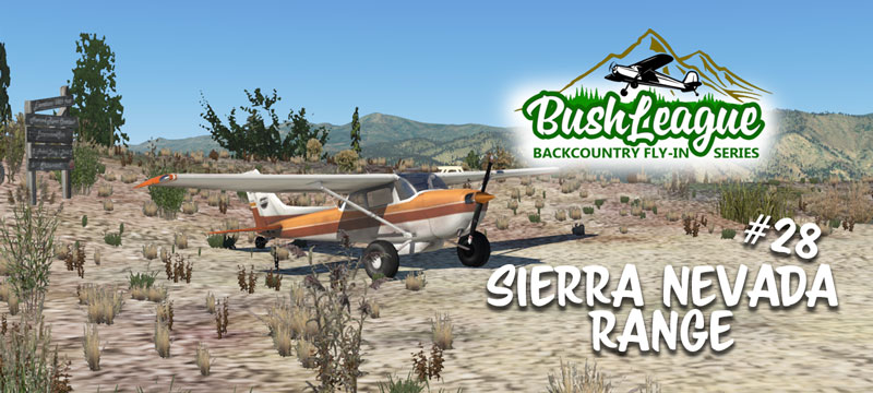
Been lost in the Sierra National Forest? No? Well maybe I can help with that! This month we’ll be exploring eastern California. We’ll be starting at KBIH, Eastern Sierra Regional Airport and finishing our adventure somewhere in the Sierra National Forest… exactly where is up to you! You’ll want to spend some time studying the map on this flight, and hope the weather is clear! Stop by the airport terminal/office on Monday, February 7, 8:00pm EST and have a look around. You’ll be working for Sierra Flight Service.
Bush League Basics:
- Everyone is welcome! Whether you’re an expert or beginner with flight simulators, radio communications, or navigation, etc., you’re invited! We’re a friendly bunch and enjoy learning from each other.
- Leave your GPS at home (or only for an emergency). That’s adds to the fun and challenge. Unless your pilotage and dead reckoning skills are excellent, you might want to be familiar with the navigational aids in the area. I’m still lost!
- We encourage you to join the VATSIM network and use the CTAF frequency of 122.8 to announce positions. Plan on some extra time here, as VATSIM just released the Velocity feature and requires a new client software program.
- We’ll also use the Downwindsim Discord voice channel during the flight for non-ATC related chit-chat.
- As always, the main goal of these flights is to have fun, practice your navigation skills and good airmanship. The event is intended to be flown in real time with real weather, unless the area is strictly IFR conditions, then we’ll want to modify the weather and give us at least a fighting chance of finishing this flight.
- As an additional level of difficulty, try to complete this flight with a piston-powered engine. Some of the field altitudes and mountain passes are WAY up there. I tried during testing, and I’m not sure if this will work. 🙂
Ortho4XP Scenery Installation Instructions:
All the airstrips are developed, tested and designed to work with Ortho4XP scenery tiles. You’ll need to cook tiles +36-119, +36-120, +37-119, +37-120. These are the settings I used to cook my Ortho4XP tile… I’d recommend the same! Also, I used “ARC” for the imagery source as this provided a bit more consistency during the scenery design process. Again, I’d recommend the same. I’ve also provided links to modified OSM data files for the two tiles +37-119 and +37-120. These help shape the terrain immediately around airstrips and also add missing water features. If you’re not sure how to use the modified OSM data, here’s a short video.
X-Plane Scenery Installation Instructions:
I JUST DISCOVERED AN ERROR IN THE SCENERY… I’m working on fixing it right now and will update this page when updated. The link below has now been updated with the correction. If you download the scenery pack before Feb. 7, 2022 at 11:00pmCST, then grab this. You’ll see an updated Readme file in the Coyote Flat folder. Sorry for the oversight.
2022-02 BL Sierra Nevada Range courtesy DWS.
A special thanks goes our good friend Wookie for several sceneries used.
Download and unzip these into your X-Plane/Custom Scenery folder. You might already have KBIH Eastern Sierra Regional (Bishop), Table Mountain and/or the Merced River Overlook, if so, you’ll want to back those up and use these versions. They have a few additional items to help with the “adventure.”
A word about forests and trees…
I use the US Forests and Woodland for Ortho scenery 1.0.0 addon from antwob. This addon provides more accurate foliage coverage and works great with Ortho4XP. I’ve modified the .for files used in tiles +37-119 and +37-120 to use coniferous trees instead of tropical trees which better match the area. You can download my modified .dsf files here. They should be placed in the X-Plane/Custom Scenery/us-forests/Earth nav data folder, replacing the files that are there.
If you get stuck or have a question, drop a message on the DownwindSim Discord bush-flying text channel. We’ll be happy to help and we look forward to have you join us on the Bush League Backcounty Fly-In Series! Don’t forget your map (and maybe some supplemental oxygen).